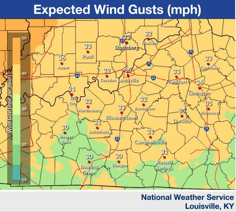
| ● Southerly wind gusts of 30-40 mph expected, but
can’t rule out a few gusts up to 45 mph.
● Windy conditions continue into Thursday
morning.
Late tonight-Thursday AM:
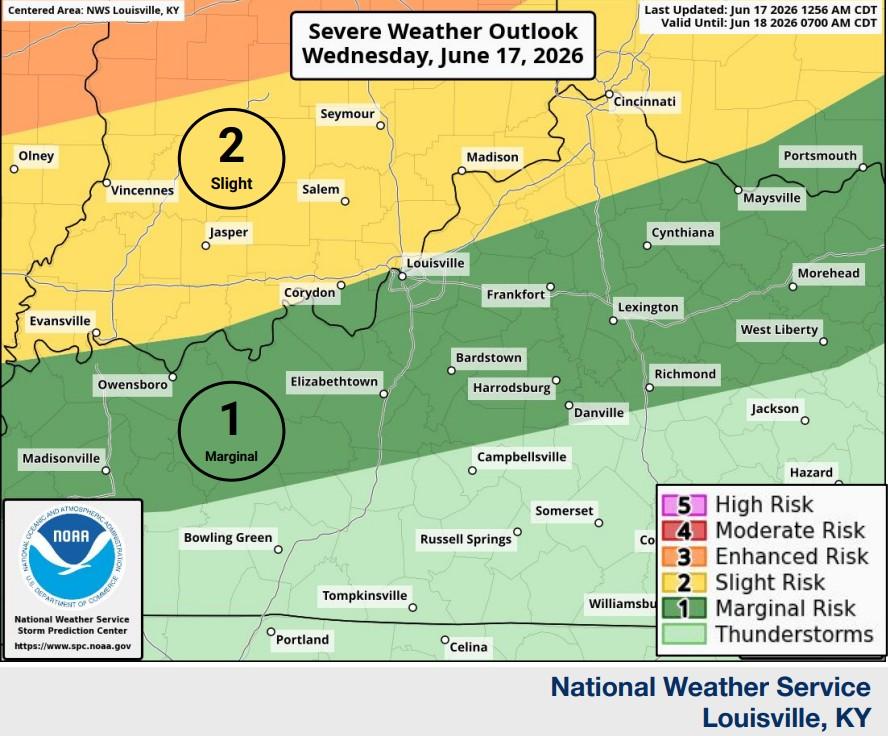
● A strong area of low pressure and a slow-moving cold front will
bring severe storm chances late tonight into early Thursday
morning. Damaging winds and a few tornadoes are possible.
● Greatest Severe Potential: north of the Ohio River and I-71
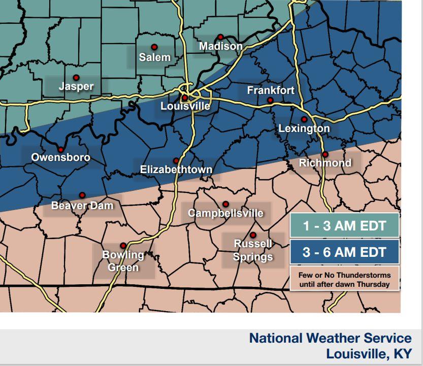
● Expect to see a line of thunderstorms approach southern IN from
the north late tonight.
● That line will continue to push south of the Ohio River between
3-6 AM EDT Thu morning.
● Coverage and likelihood of storms will decrease to the south
through Thu morning
Thursday Afternoon:
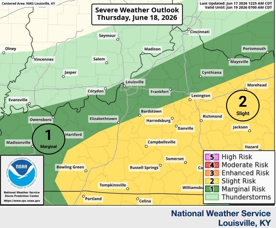
● The cold front will slowly move across the area on Thursday,
leading to heavy rainfall and additional thunderstorms.
○ Some thunderstorms are expected to be strong to severe, with
damaging winds the most likely hazard possible.
● Greatest Severe Potential: Along and Southeast of the WK/BG
Parkways |