| ● A strong area of low pressure near the Great Lakes will create
gusty winds across the Ohio Valley this afternoon and into
tonight.
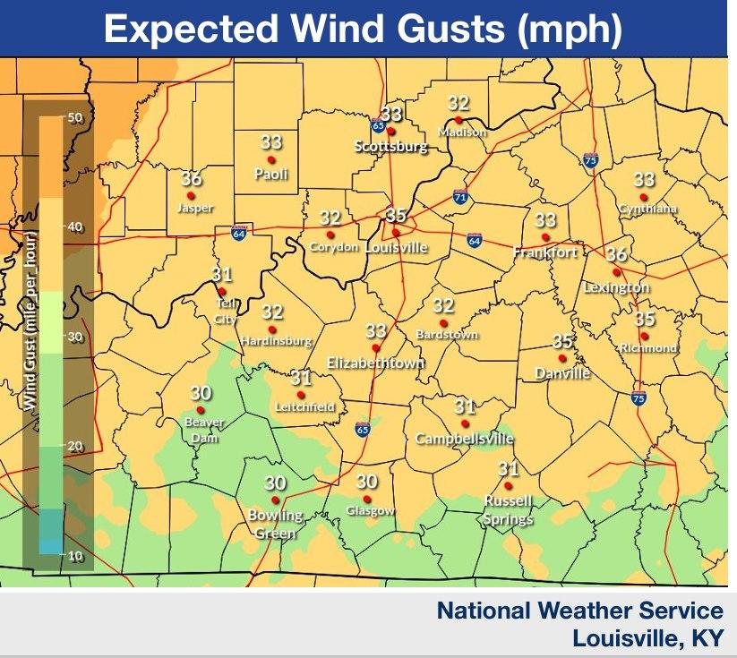
● Southerly wind gusts of 30-40 mph expected, but can’t rule out a
few gusts up to 45 mph.
● These winds will make driving more difficult, especially for larger
vehicles traveling on east-west oriented roads. Use extra caution.
● Windy conditions continue into Thursday
morning. Secure any loose outdoor items.
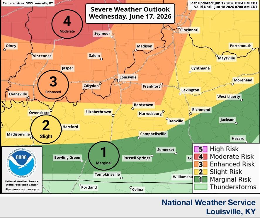
Severe Weather Round 1: Late Tonight - Thursday Morning
● A strong area of low pressure and a slow-moving cold front will
bring severe storm chances late tonight into early Thursday
morning. Damaging winds and a few tornadoes are possible.
● Greatest Severe Potential: along and north of the Western
KY/Bluegrass Parkways
● Expect to see a line of thunderstorms approach southern IN and
north central KY from the north late tonight.
● Coverage and likelihood of storms will decrease to the south
through Thu morning
● Timing in our area for Round 1 is from midnight to 4AM
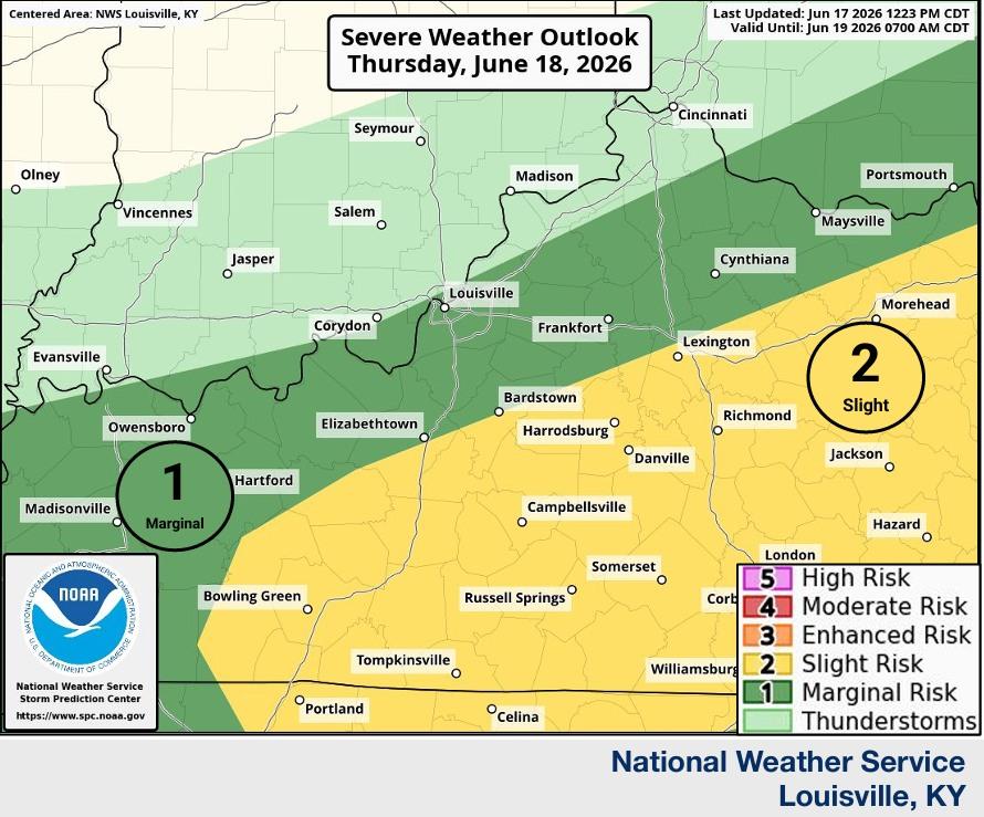
Severe Weather Round 2: Thursday afternoon
●The cold front will slowly move across the area on Thursday,
leading to heavy rainfall and additional thunderstorms.
○ Some thunderstorms are expected to be strong to severe
○ Damaging wind is most likely hazard
●Greatest Severe Potential: Along and
Southeast of the WK/BG Parkway
● The timing in our area for Round 2 is 1PM-8PM |